
80-Year-Old Aerial Photograph Hides Irrefutable Evidence of the Japanese Army's Invasion of China: The Changxindian-Tuoli Railway Branch Line
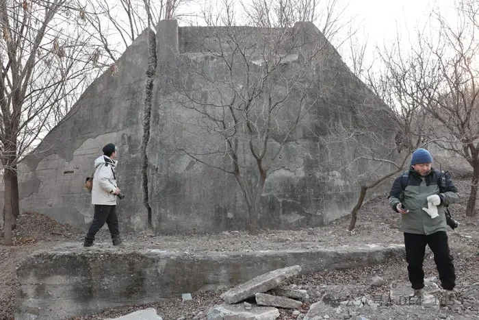
Concrete abutment
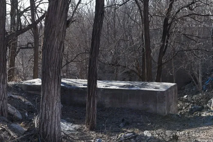
Bearing pad on the hillside
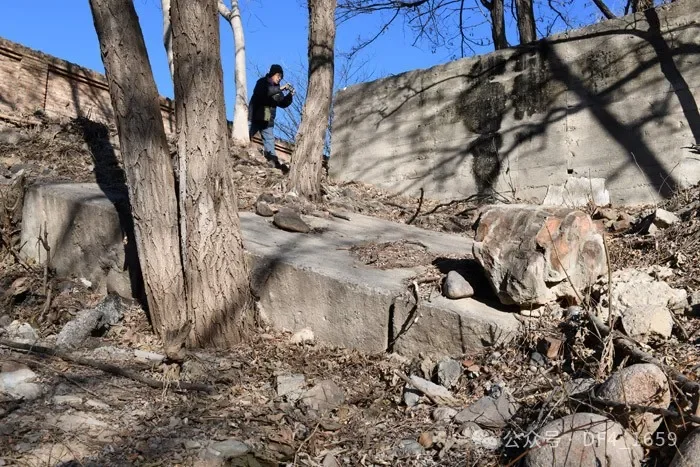
Collapsed abutment
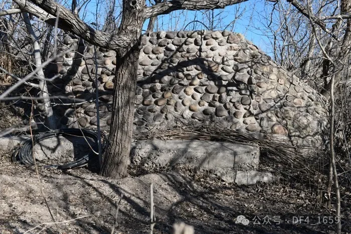
Concrete mortar-grouted pebble abutment
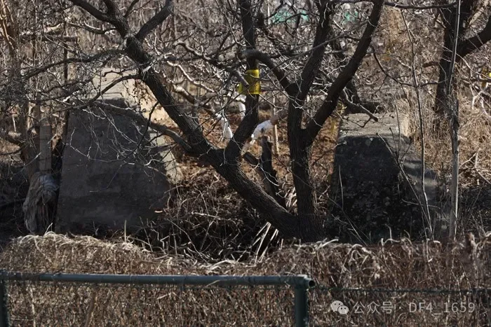
Two adjacent abutments
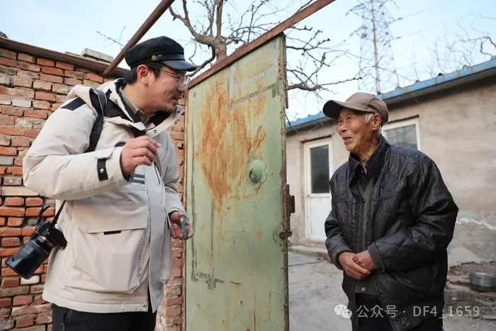
Wang Wei inquires about the history of the abutment from elderly Guo Shu
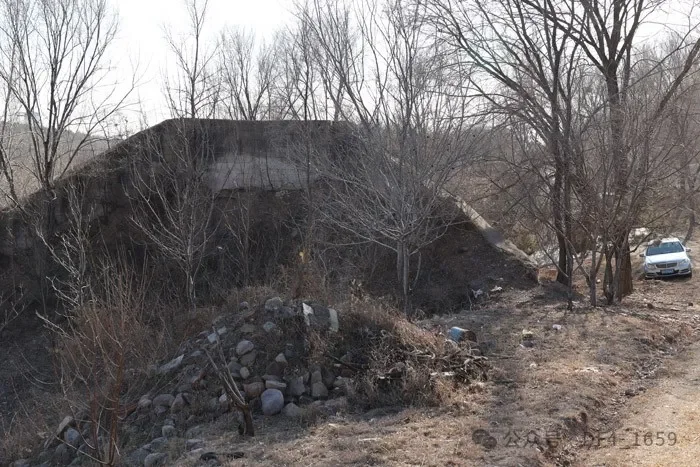
Concrete abutment
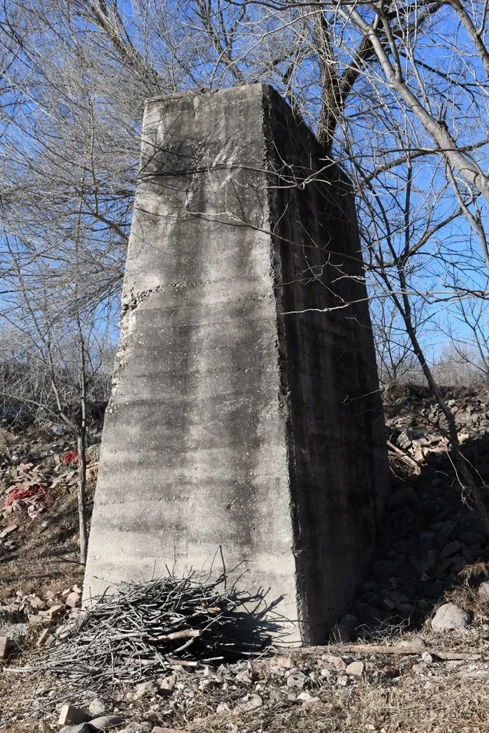
Concrete pier
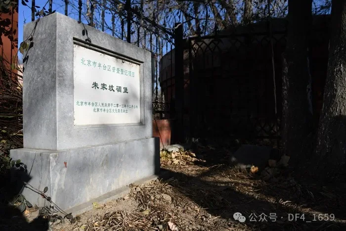
Cultural heritage protection sign for the Zhujiafen blockhouse
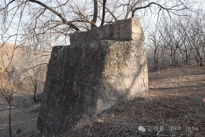
Abutments on Taipingling
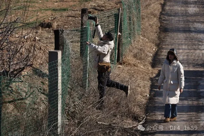
Wang Wei photographing the railway embankment in Houjiayu
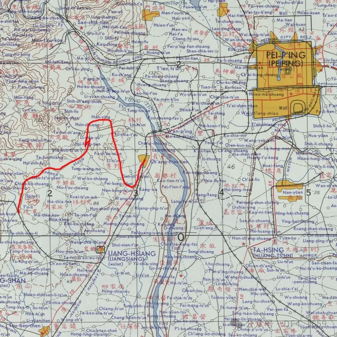
Schematic diagram of the alignment of the Changxindian-Tuoli Railway
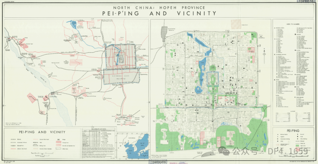
Map of Peiping and its suburbs on July 31, 1945, marking the Changxindian-Zhujiafen-Huaishuling section of the Japanese military railway.
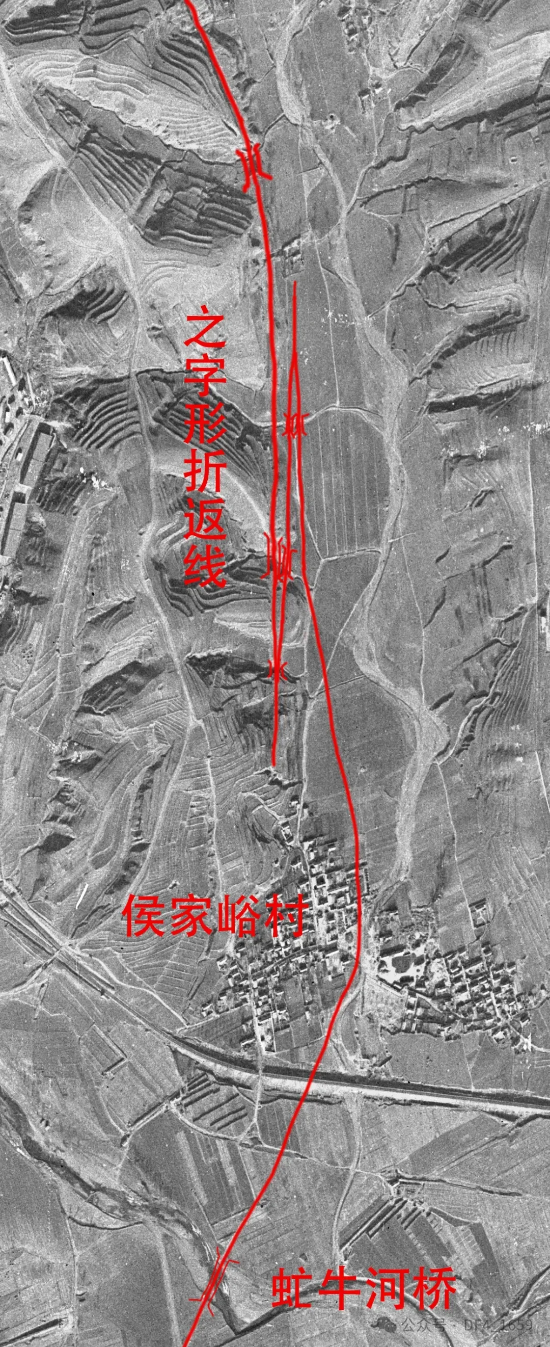
1966 aerial photograph showing the remnants of the Houjiayu switchback line.
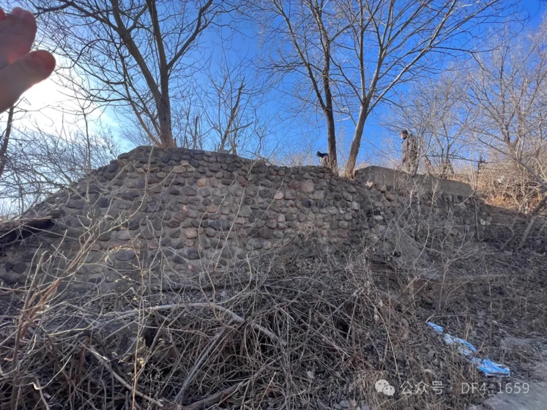
Remnants of the pier for the No. 2 switchback line in Houjiayu. The high abutment on the right (upper-level line) is the main line from switchback line No. 1 to switchback line No. 2. After switching back here, the line extends toward Tuoli via the low abutment on the left (lower-level line).
On January 6, 2025, Beijing Youth Daily
Reported that a set of 1945 aerial photographs captured the historical landscape of the area west of Lugou Bridge 80 years ago. After carefully studying this set of photos, a railway culture scholar discovered a mysterious, previously unheard-of railway line hidden within them. He conducted in-depth, multi-source investigations in the shallow mountainous areas of western Beijing, ultimately locating the remnants of railway abutments in Xinzhuang Village and Houjiayu Village, Fengtai District.
The year 2025 marks the 80th anniversary of the victory of the Chinese People's War of Resistance Against Japanese Aggression and the World Anti-Fascist War. This railway, approximately 30 kilometers long, connecting two Japanese military barracks and leading directly to the coal-producing area in western Beijing, adds yet another piece of irrefutable evidence to the crimes of Japanese imperialism in invading China. Recently, reporters from Beijing Youth Daily reported the preservation status of this railway's remnants to the Daxing District Cultural Heritage Administration [Note: Fengtai District Cultural Heritage Administration], awaiting relevant departments to conduct on-site inspections.
The Mysterious Railway in Old Photographs
Not long ago, railway culture scholar and Beijing Cultural Heritage Protection Association member Wang Wei purchased access rights to a batch of 1945 aerial photographs from an overseas commercial website. Among these aerial images, four photos recorded the terrain, rivers, villages, towns, and road networks of the area west of Lugou Bridge at that time. Some photos were taken looking northwest from the sky above today's Changyang, Fangshan, while others were taken looking south from the sky above today's Garden Expo Park. The website did not indicate the author of these aerial photos; Wang Wei surmises they may have originated from the Sino-American Composite Wing at the time—as mentioned in the book Crimes of the Japanese Invaders in Fengtai: after 1944, the U.S. Army Air Forces began attacks behind enemy lines, and American aircraft could frequently be seen circling over Changxindian.
Despite their "unknown origin," the four photos caught Wang Wei's attention. After careful comparison, he discovered that a completely unprecedented railway line was hidden within this set of photos. Wang Wei noted that although the photos were taken 80 years ago, they possessed relatively high clarity. The traces of roadbeds and cuttings on the ground were obvious, and the line wound its way extending westward with a curve radius significantly larger than that of a highway, leading him to conclude that this was a railway.
Referring to the aerial photographs, Wang Wei outlined the course of this mysterious railway: starting from Changxindian, it extended southwest to Zhujiafen, turned northwest to Huaishuling, went west through Xinzhuang Village, then turned south to Houjiayu, subsequently wound westward into today's Fangshan District via Shangwan Village, and finally connected with the Liangxiang-Tuoli Branch Line of the Peking-Hankou Railway about 1.5 kilometers south of Tuoli Railway Station, spanning a total length of nearly 30 kilometers and connecting the western part of today's Fengtai with the eastern part of Fangshan.
What puzzled Wang Wei was that although this railway could be clearly distinguished in the aerial images, it seemed to have never been made public, and existing historical and literary records contained no relevant documentation about it. "If it were a railway built independently by Chinese people, it is impossible that there would be no historical records. I suspect this railway was built between 1937 and 1945, serving as a military line planned by the invading Japanese army," Wang Wei said.
Abutment Remnants Found in the Ravines
"Even if the railway has no tracks left, it is impossible for it to have completely vanished, especially in mountainous sections where remnants like abutments are very likely to remain." To verify the existence of this railway, Wang Wei decided to conduct an on-site exploration. Referring to the aerial photographs, he locked his exploration points on Taipingling, north of Houjiayu Village and south of Xinzhuang Village, where gullies are dense.
Nangou Road, located in the shallow mountainous area of western Fengtai, winds its way through narrow, north-south ravines. Standing here and looking west toward Taipingling, concrete abutments can be seen looming in the mountain forests. Climbing Taipingling, one can observe more than ten abutments and bearing pads distributed north-south across the slope—which is high in the west and low in the east—acting like historical landmarks that define the railway's route. The abutments stretch north to Xinzhuang Village and south to Houjiayu, over a length of about 1.5 kilometers, basically matching the path shown in the aerial photos. According to several local villagers, these abandoned abutments were all left behind when the Japanese army built the railway.
All signs indicated that Wang Wei's judgment was correct: a railway did indeed exist here. After nearly a century of wind and rain erosion, the long-abandoned railway had long since lost its bridges and tracks; some embankments were destroyed and gone, one abutment had collapsed, the northernmost abutment retained only traces, and most abutments had trees as thick as bowls growing around them. The surviving abutments and bearing pads were mostly made of poured concrete and had a hard texture. To enhance structural stability, some abutments were also built with splayed wing walls, but affected by terrain changes and other factors, most wing walls showed obvious cracking.
In addition, on the hillside of Houjiayu Village, three "concrete mortar-grouted pebble abutments" were found. Wang Wei stated that railway abutments masonry-built with large cobblestones are quite rare; these cobblestones were sourced locally, proving that construction materials were relatively scarce at the time.
Worth mentioning is that on the east side of the abutment line, inside an orchard in Houjiayu Village, two relatively independent concrete abutments were also discovered. Comparing and analyzing them with the aerial photographs, Wang Wei concluded that the railway featured two "switchback" (zig-zag) reversing lines in Houjiayu, lengthening the railway to reduce the gradient, allowing trains to achieve ascent after reversal within a shorter distance. "This is the same principle as the Qinglongqiao switchback line on the Jingzhang Railway, but the railway in Houjiayu has two reversing lines connected together, which is extremely rare," Wang Wei said.
The "Short-Lived" Railway in Memory
In Wang Wei's view, the reason these abutments and bearing pads have survived to this day is related to their mountainous location, which kept them away from large-scale urban construction. "Even during rural land leveling, demolishing these concrete structures is quite laborious, which is why they managed to be preserved." Due to the lack of formal written records, Wang Wei subsequently visited nearby villages to conduct an oral history investigation regarding this railway.
Eighty-nine-year-old villager Guo Shu from Houjiayu Village recalled that the abandoned abutments north of Houjiayu Village were once a railway line built under the direction of the Japanese. "The people doing the labor were all Chinese civilian workers. The railway extended southwestward through Houjiayu all the way to Tuoli, and the Japanese wanted to use this railway to transport coal from Tuoli." During the conversation, a term used by old man Guo Shu caught Wang Wei's attention—the old man said that after the railway was completed, only a few test runs were made using a "Motor Car" before the Japanese announced their unconditional surrender, and the bridges were subsequently dismantled by people sent from nearby factories, leaving behind only the row upon row of abutments.
Wang Wei believes that the "Motor Car" mentioned by the old man should be the Japanese-inflected English term "Motor Car," referring to engineering vehicles operating on railways. Such terminology is relatively common in Japan, where Japanese people still refer to maglev trains as "Linear Motor Cars."
Seventy-year-old Houjiayu villager Wang Zhensheng recalled that since childhood, he had heard the older generation in the village say that this railway was built by the Japanese to plunder the mineral resources of western Beijing. The railway was built all the way from Huaishuling, extending through Houjiayu to Tuoli, and "switchback" reversing lines were also built in Houjiayu, with piers and bridges constructed of timber frames. However, this railway was dismantled before 1949, and ever since he could remember, only concrete abutments remained.
Could railway bridges be constructed using timber? Wang Wei analyzed that judging from the construction scale, this railway was not a trunk line, and its construction standards were not high—which is usually related to the construction funds and technical level of that time; therefore, the possibility of piers and bridges being constructed using timber entirely exists. "For example, in Canada, some railway bridges still use piers and bridges built with timber. However, given the scarcity of existing historical records, various questions about this railway may still need to find answers from Japanese historical archives," Wang Wei said.
Connecting Two Japanese Military Barracks
To understand the full picture of this railway, Beijing Youth Daily reporters found through field visits and document reviews that all four key nodes of the line had left marks of the Japanese invaders, including two Japanese military barracks.
Changxindian, the starting point of the railway, is located on the bank of the Yongding River in Fengtai District. It was a major commercial hub in southwest Beijing during the Ming and Qing dynasties, and the Peking-Hankou Railway also established a station here. After the outbreak of the July 7 Incident in 1937, Japanese troops occupied Changxindian on July 28, designating it as a strategic stronghold and establishing a puppet Wanping County government, a gendarmerie, and a police station there. West of Changxindian Railway Station, there is an abandoned water tower, and the cast-iron pipe fittings inside the tower still bear the characters "Showa 13" (1938).
Aerial photographs from 1945 show that this railway extended southwest from Changxindian to Zhujiafen, where rows of barracks—suspected to be Japanese military barracks—can be seen in Zhujiafen. According to confirmation by multiple local villagers, during the War of Resistance Against Japanese Aggression, the Japanese army stationed infantry, cavalry, and artillery in Zhujiafen, with many soldiers coming from Hiroshima; local villagers called them the "Oda Unit." In the Zhujiafen area, four brick-built blockhouses also survive, which were announced as Fengtai District census-registered cultural heritage items in 2013.
The railway extended northwest from Zhujiafen, turning southwest to Huaishuling, where even clearer barracks architecture can be seen, matching historical records—the Place Names of Fengtai District, Beijing records that after the "July 7 Incident" in 1937, the invading Japanese army occupied Huaishuling and forced local farmers to move out, converting the area into a military camp.
According to the aerial photographs, the railway continued extending west from Huaishuling to Xinzhuang Village, then passed south across Taipingling to Houjiayu, and wound west to Tuoli. Why set the terminal at Tuoli? This was likely out of strategic considerations. According to the Place Names of Fangshan District, Beijing, during the War of Resistance Against Japanese Aggression, Tuoli was one of the important strategic targets for the invading Japanese army to attack and blockade the Pingxi Anti-Japanese Base Area. Additionally, according to an article in Fangshan Historical and Cultural Materials, "The Rule of the Japanese Invaders in the Tuoli Area," to plunder coal resources, the invading Japanese army restored high lines and railways in the Tuoli area.
The question then arises: to solve the fuel supply for steam locomotives on the Peking-Hankou Railway, the Tuoli Branch Line of the Peking-Hankou Railway had already been completed as early as 1904. This branch line started from Liangxiang Station on the Peking-Hankou Line and established a station at Tuoli Village, and coal resources in the mountainous area west of Tuoli could also be transported out via this line. Why was it necessary to build a new railway on top of the existing line?
According to Wang Wei's analysis, the railway built by the Japanese army was likely a "military line," connecting the military barracks at Zhujiafen and Huaishuling to strengthen the military blockade against the Pingxi Anti-Japanese Base Area. At the same time, they coveted the coal west of Tuoli and perhaps also wanted to rely on this line to plunder more resources.
The Discoveries of Folk Scholars Have Historical Supplement Value
Interviewer: Liu Weidong, Member of the Beijing Cultural Heritage Authentication Committee
Beijing Youth Daily: This railway lacks written records. How high is the credibility of the investigation?
Liu Weidong: Through aerial photographs purchased from overseas websites, Wang Wei uncovered historical memories that had been sealed for many years. Although this railway no longer exists, he still relied on strong investigative skills to find the scarce architectural remnants. In situations where historical materials are scarce, Wang Wei determined the builder and construction time of this railway through oral history investigations. With physical objects, imagery, and villagers' oral accounts as evidence, it possesses higher credibility compared to hollow research, and this also provides research clues for cultural and historical workers. From the perspective of the history of the War of Resistance, the motives of the Japanese in building this railway and the line design itself possess extremely high research value.
Beijing Youth Daily: Do the surviving abutment remnants possess preservation value?
Liu Weidong: Since 1949, China has conducted three national cultural heritage censuses and is currently conducting the fourth. The year 2025 marks the 80th anniversary of the victory of the Chinese People's War of Resistance Against Japanese Aggression and the World Anti-Fascist War. It is recommended that the cultural heritage departments of Fengtai District include the abutment remnants in Xinzhuang and Houjiayu into the "Fourth Census" clues, launching investigations following Wang Wei's discovery. Looking across the Beijing region, many Japanese military relics have already attained cultural heritage recognition—such as blockhouses, aircraft shelters, and cliff inscriptions—but abutments built by the Japanese army are still relatively rare. This is very likely among the few historical remnants of this railway, and it is worth studying from the perspectives of the history of science and technology and the history of railway bridges. It must be said that Wang Wei's discovery has historical supplement value.
Beijing Youth Daily: How do you view the relics left behind by the invading Japanese army?
Liu Weidong: In 2018, I participated in the cultural heritage recognition work for the "Japanese Invaders' Merit-Commemorating Cliff Inscriptions" in Fangshan District. I also noticed that at the beginning of 2024, the Yanqing District Culture and Tourism Bureau issued the Announcement on Publishing the Badaling Tunnel Blockhouse of the Jingzhang Railway as an Immovable Cultural Heritage Item, which serves as physical evidence of the invading Japanese army controlling the Jingzhang Railway and surrounding areas. During the fourth national cultural heritage census, the Yanqing District census team also discovered an emergency evacuation steel rail about 300 meters long near Sanbao Station on the Jingzhang Railway, built by the invading Japanese army in 1939. The aforementioned cultural heritage recognition work reflects the cultural heritage departments' emphasis on such historical relics. As cultural heritage workers, protecting Japanese military relics is by no means praising aggression; rather, it is because this history cannot be ignored. These relics are real historical landmarks and constitute precious first-hand materials for related research.
Related report by Beijing Youth Daily on January 6, 2025
Text / Beijing Youth Daily reporter Cui Yifei
Photography / Beijing Youth Daily reporter Cui Yifei
Editor / Peng Xiaofei
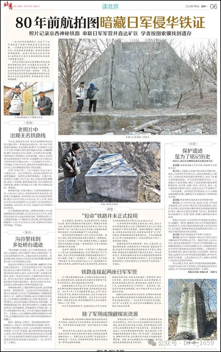
On January 6, 2025, Beijing Youth Daily
